The Digital Atlas Europa aims to provide similar information for the digital world. The right maps and atlases will show the key digital systems that surround us, how they are connected and how they influence our life.
The concept of the digital atlas is explained in more detail in an article (in Dutch) published in june 2011.
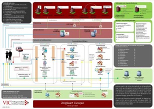
This site provides some maps for inspiration. A recent example of the use of maps is Zorgkaart Curaçao 2014 giving an overview of available health-care on the island of Curaçao. It was created by the Volksgezondheid Instituut Curaçao.
Two example maps are available. The first one provides an overview of the Dutch healthcare system (a description in Dutch is here).

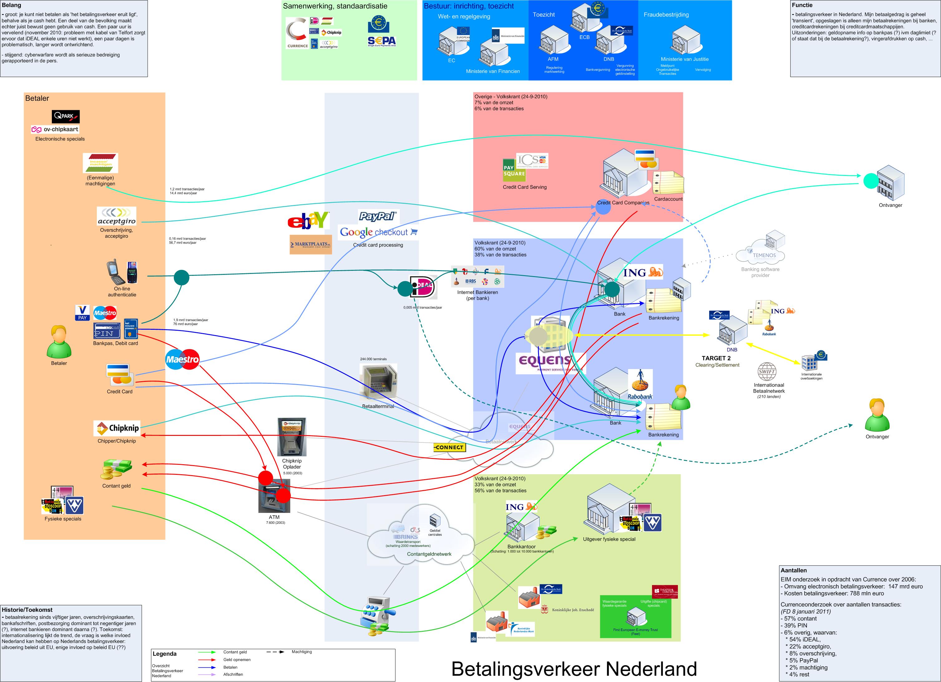
Another map has been developed for the payment domain in the Netherlands.
Other maps will follow soon.
Digital Atlas Europa is an initiative of Jan Turk (ITsucces), Gert Florijn (M&I/Partners) and Adri de Bruijn (PWC).
For comments, ideas or contributions, send an email.